

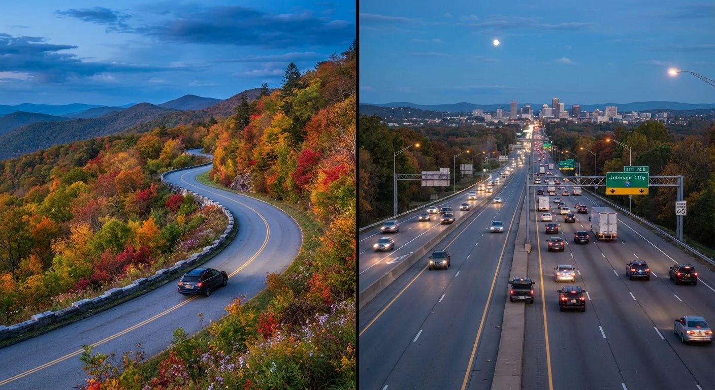
Key Takeaways
- Scenic routes add time and unpredictability but reward drivers with richer experiences and memorable landscapes.
- Interstates are faster, more predictable, and better suited to tight schedules or long-distance hauls.
- A hybrid approach — mixing scenic sections with interstate stretches — often delivers the best of both worlds.
- Fuel, cell service, and lodging availability can be significantly limited on remote byways.
- Your vehicle condition, travel companions, and trip purpose should all factor into your route decision.
Option A
Scenic Routes
The slow-travel, experience-first choice.
Best for: Travelers who want landscapes, local character, and memorable detours to be part of the journey itself.
Option B
Interstates
The efficient, reliable backbone of American road travel.
Best for: Drivers who need to cover distance quickly, stay on schedule, or prioritize predictable fuel and rest stops.
If you have a firm deadline or limited vacation days
Interstates
Interstates offer predictable travel times and fewer variables, helping you arrive when you planned without burning extra days on detours.
If the journey is the destination
Scenic Routes
Byways deliver the landscapes, small towns, and spontaneous stops that become the stories you tell long after the trip ends.
If you're traveling with young children or passengers prone to motion sickness
Interstates
Smooth, wide lanes and frequent service plazas make family comfort and bathroom breaks far more manageable on the interstate.
If you want to explore a specific region's culture or geography
Scenic Routes
Designated byways often pass through historic districts, national parks, and landscapes that interstates bypass entirely.
If you're driving a long total distance but want one highlight stretch
Interstates
Use the interstate for the bulk of your mileage, then drop onto a scenic route for the section that matters most — saving time without sacrificing the experience.
What You're Actually Choosing Between
When most drivers think about routing a road trip, they default to whatever the navigation app suggests — which is almost always the fastest path, typically an interstate. But that default skips a real decision worth making deliberately.
Scenic routes — including federally designated National Scenic Byways, state-maintained heritage corridors, and well-known drives like the Blue Ridge Parkway — are roads chosen for their intrinsic travel value. They follow coastlines, cut through mountain passes, and trace river valleys. The tradeoff is time: speeds are lower, services are sparse, and detours are part of the experience.
Interstates, by contrast, are engineered for throughput. Wide lanes, controlled access, regular rest areas, and consistent signage make them the least-stressful way to move across the country. What they rarely offer is a sense of place.
Understanding this core distinction — experience versus efficiency — is the foundation of smarter route planning. For a broader look at what makes any road trip work, see our guide to road trip anatomy.
| Criterion | Scenic Routes | Interstates |
|---|---|---|
| Typical speed | 25–55 mph | 65–75 mph |
| Travel time for same distance | Significantly longer | Fastest option |
| Fuel stop frequency | Sparse; plan carefully | Frequent, every 20–40 miles |
| Cell service reliability | Unreliable in remote areas | Generally consistent |
| Scenery and experience | High — landscapes, towns, landmarks | Low — uniform, functional |
| Traffic and congestion | Usually light | Varies; heavy near cities |
| Lodging availability | Limited; book in advance | Abundant near exits |
| Driver fatigue profile | Engaging but physically demanding on curves | Monotonous over long stretches |
The Real Tradeoffs: Time, Fuel, and Logistics
The time gap between scenic and interstate routing can be surprisingly large. A stretch that takes two hours on an interstate might take four or five on a byway — not just because speeds are lower, but because scenic roads invite stops. That's a feature for some travelers and a problem for others.
Fuel planning deserves special attention on scenic routes. Gas stations can be 50 or more miles apart in rural or mountainous sections. Checking fuel availability before you leave — and topping off whenever you're above a half tank — is a practical habit on any byway.
Cell service is another variable. Many scenic corridors pass through areas with little to no coverage, which affects navigation, emergency contact, and finding lodging on the fly. Downloading offline maps before departure is strongly advisable.
Interstates largely solve these logistics: fuel, food, and lodging cluster around exits at predictable intervals. For travelers on tighter schedules or those less comfortable with uncertainty, that predictability has genuine value.
150,000+
Miles in the US National Scenic Byways program
The Federal Highway Administration's National Scenic Byways program designates routes across all 50 states based on scenic, natural, historic, and cultural qualities.
48,000+
Miles in the US Interstate Highway System
The Interstate Highway System, established under the Federal Aid Highway Act of 1956, connects all major US metropolitan areas and remains the primary long-distance driving network.
Thinking through your stopping strategy is equally important either way — our piece on stops that actually improve a road trip is worth reading before you finalize your route.
When to Combine Both — and How
Few road trips need to be entirely one or the other. A hybrid approach — often called a "spine and detour" strategy — uses the interstate as the backbone and dips onto scenic routes for the most rewarding sections.
For example, driving from the Mid-Atlantic to the Deep South might mean using I-81 for the bulk of the distance, then cutting onto the Blue Ridge Parkway for a day's drive through Virginia and North Carolina. You cover ground efficiently, then slow down when the scenery earns it.
This approach also reduces pressure on planning: you're not committed to a scenic road when weather, fatigue, or timing makes flexibility the smarter call. If a mountain pass looks icy or a storm is rolling in, the interstate is always an option.
For travelers building a detailed day-by-day plan, constructing a practical road trip itinerary explains how to structure this balance in practice. And if you're exploring iconic American corridors, our reference guide to iconic US drives covers what each major route actually delivers.
Check Road and Weather Conditions Before You Go
Scenic byways — especially mountain passes, coastal highways, and desert roads — can be affected by seasonal closures, wildfires, flooding, or winter weather. Before departing, check your state's department of transportation website and the National Weather Service for current conditions. Some roads have vehicle length or weight restrictions that may apply to larger trucks, RVs, or towed vehicles. Always verify entry requirements for national park roads if your scenic route passes through one.